
Hiemcke’s giant manuscript map of Suriname (1830)
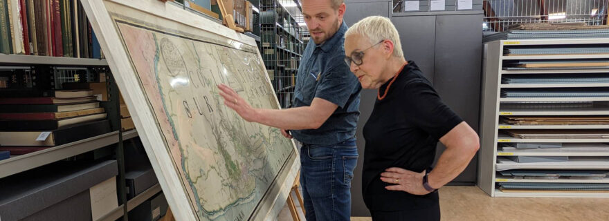
Recently, Leiden University Libraries was able to purchase a unique manuscript map of Suriname, drawn by Helmuth Hendrik Hiemcke in 1830. A missing link in Surinamese mapping history.
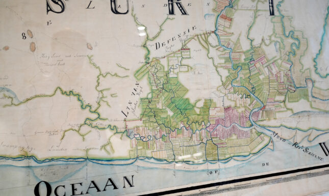
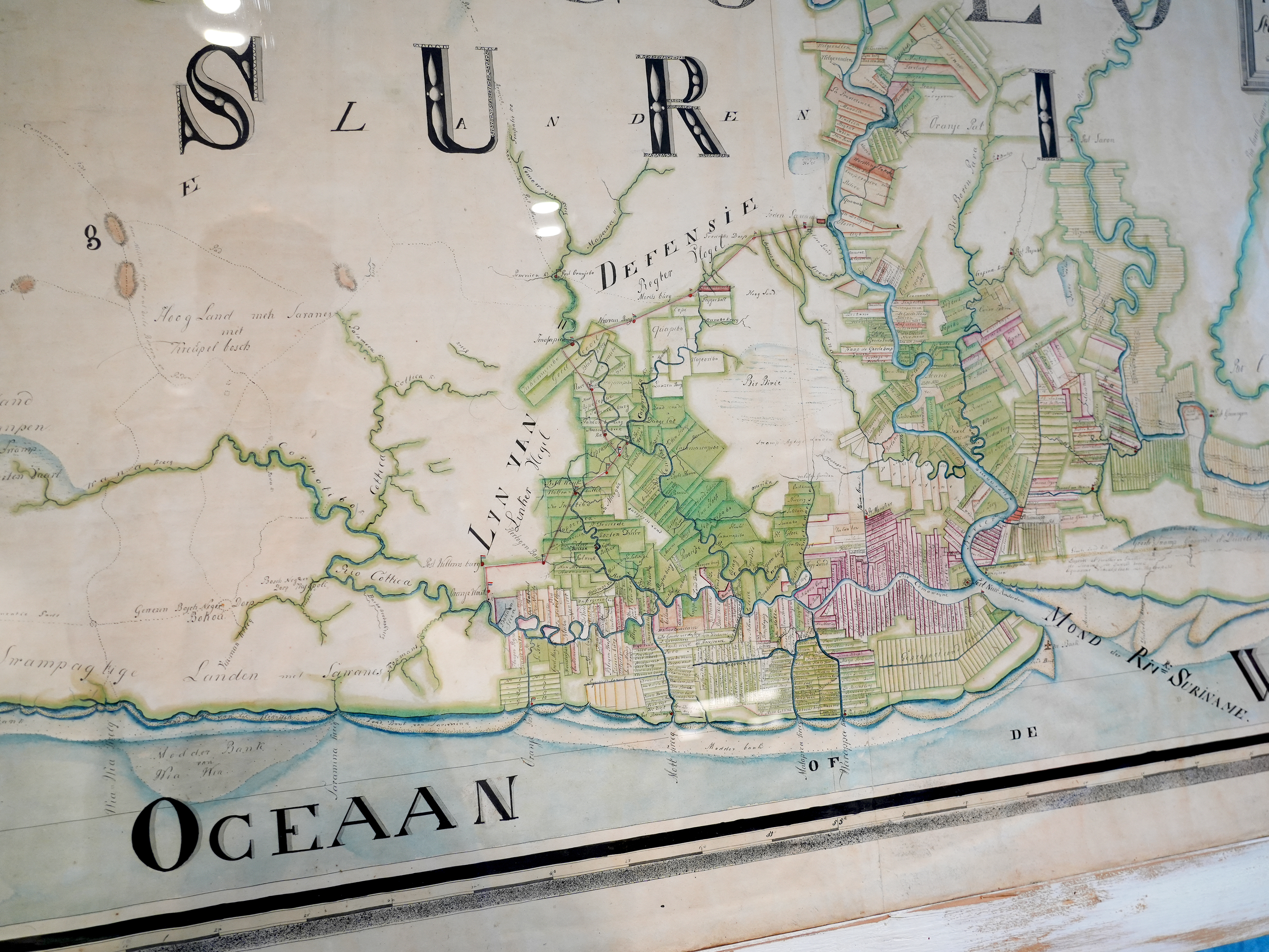
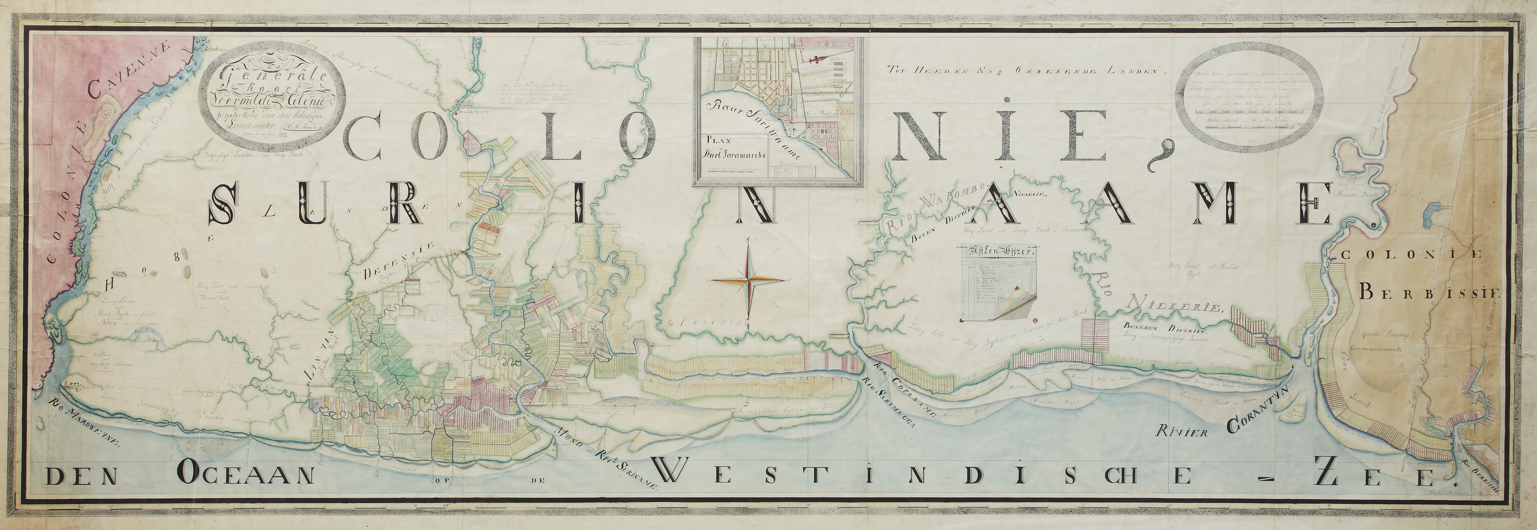
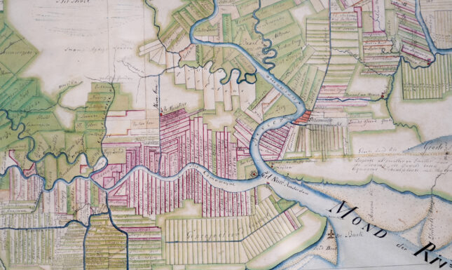
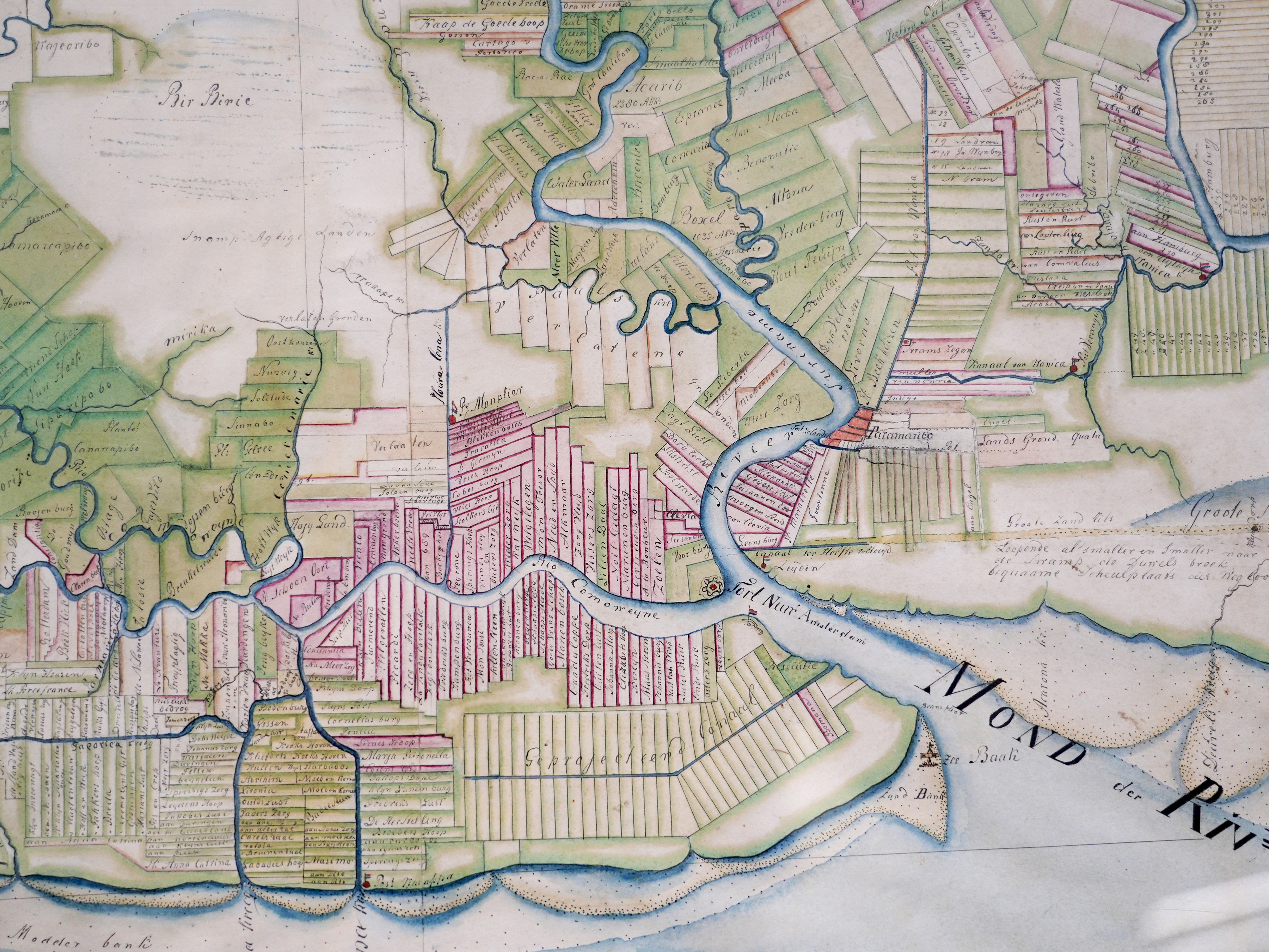
Leiden University Libraries acquired this unique piece of cartographic history with the support of the Bodel Nijenhuis Fund, the Friends of the UBL, the KITLV Foundation and various private donations. The map measures no less than 88.5 x 246.5 centimetres and shows, in great detail, the plantation society in the last decades before the abolition of slavery. Every plantation is individually identified and named. Many plantation maps of Suriname appeared in print starting at the end of the seventeenth century. Because this was not the case with Hiemcke’s map, it can be regarded as a missing link in Surinamese mapping history. Now that the map is part of the UBL collections, it is permanently accessible for research, education and anyone interested in the history of Suriname or its people.

Surinamese plantation maps
The first map of Suriname showing the boundaries of individual plantations (Amsterdam: Frederick de Wit, 1688) was commissioned by Cornelis van Aerssen van Sommelsdijck (1637-1688), the first governor of Suriname. Alexander de Lavaux's monumental wall map followed in 1737. Of this map, several derivative editions were subsequently printed. Both of these maps were limited to the plantations along the Suriname River, Commewijne and Cottica. The eight-page map by Johan Christoph Heneman (Amsterdam: Gerard Hulst van Keulen, 1784), was the first to map the entire coastal area up to the Berbice. Moreover, Heneman's map was the first to make an effort to map the main rivers further inland. J.H. Moseberg’s map from 1801 was, again, limited to the core colonial area of Suriname. All these maps have a similar scale, varying between 1:150,000 and 1:200,000.
The large map
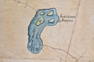
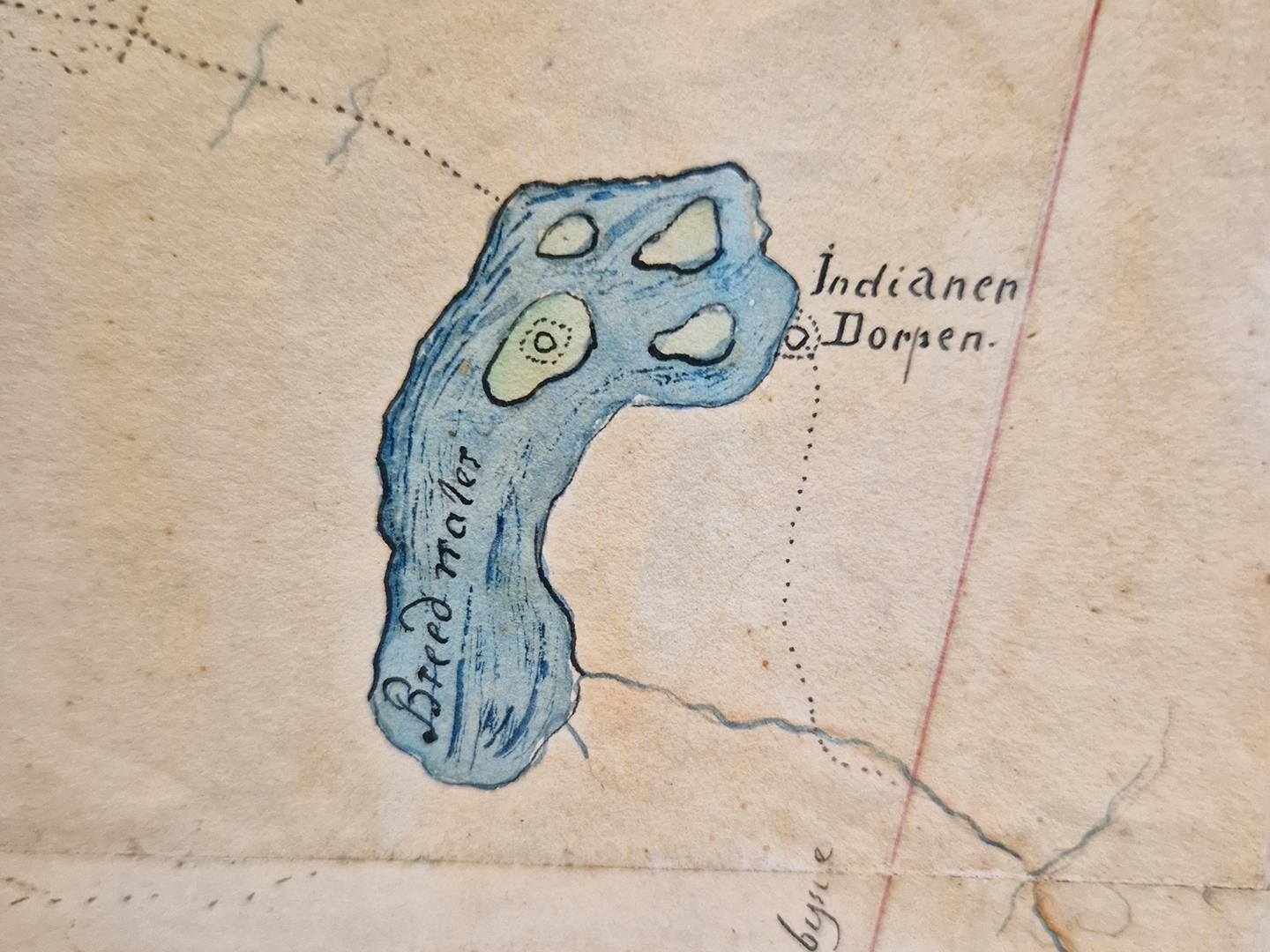
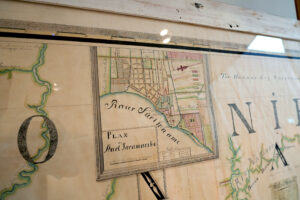
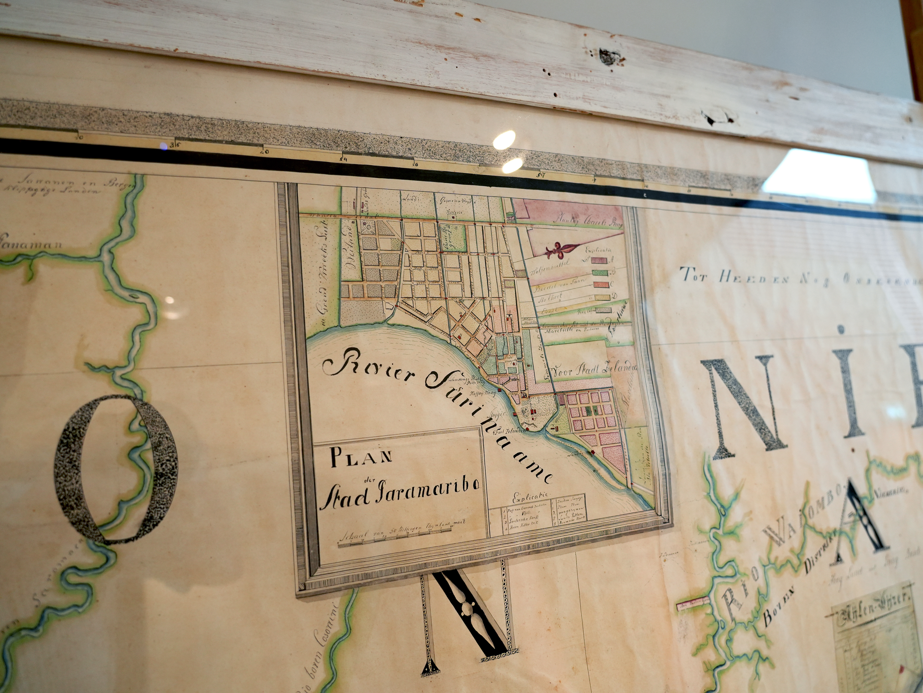
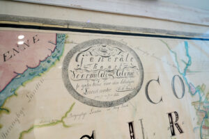
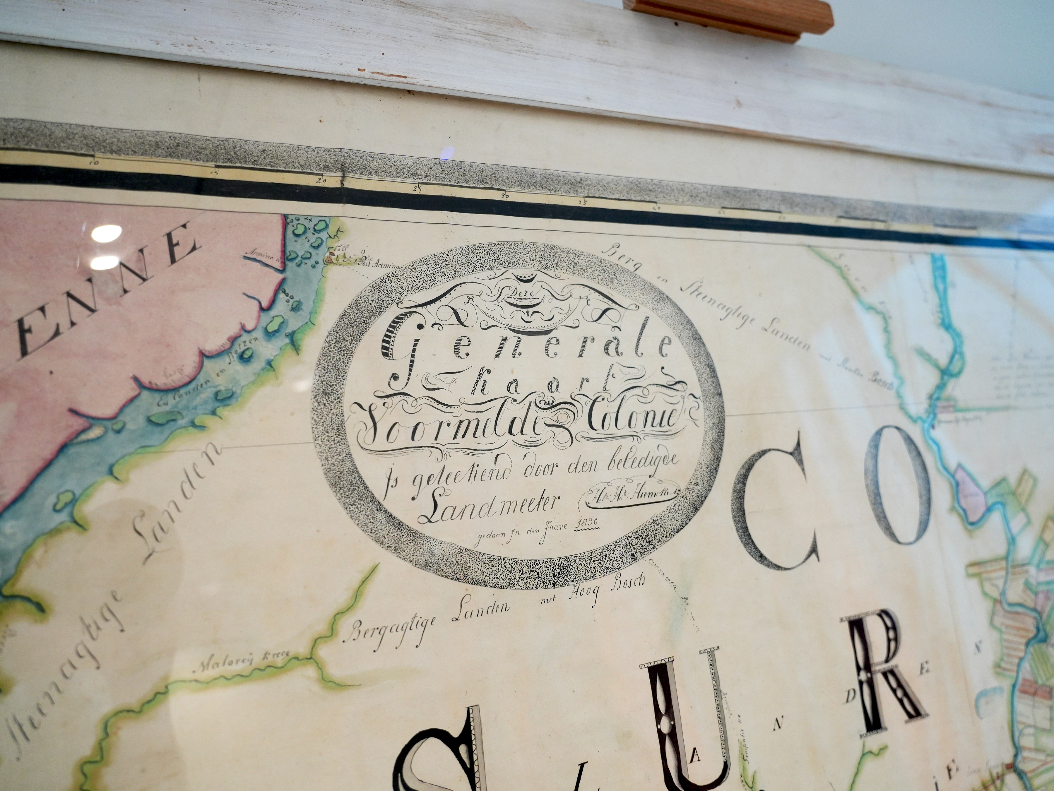
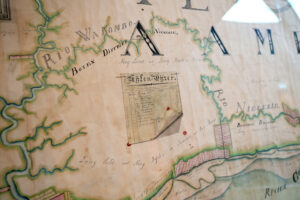
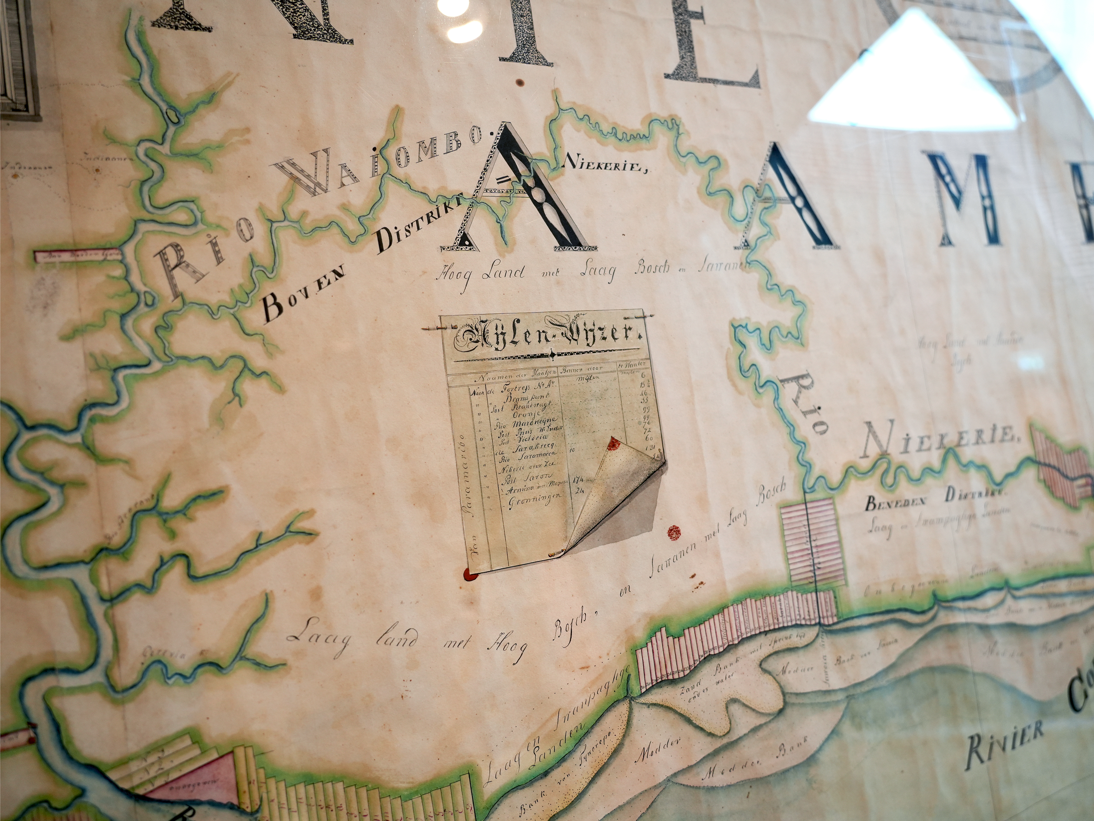
Like almost every map of Suriname mentioned above, Hiemcke's map is oriented to the south, as if you were looking at the country from the sea. Hiemcke's map includes the entire coastal strip of Suriname between the border rivers the Marowijne in the east and the Corantijn in the west. Hiemcke clearly used Heneman's map as a basis, but updated it to the situation in 1830. The plantations are coloured green, yellow, red and orange. Further research should determine whether these colours indicate the crops grown on the plantations, as is the case on the smaller-scale map of Mabé (Groningen: H. Eekhoff Hz., 1835). In the relatively empty interior, in addition to the rivers, various military posts, villages of aboriginal inhabitants (‘Indianen Dorpen’) and Maroon villages (‘Gewezen Bosch Neger Dorp’) have been mapped. Other striking elements on the map include a trompe-l'œil 'Mijlen-Wijzer', which lists the distances from Paramaribo to various places, and an inset map of Paramaribo, based on a printed map by Albrecht Hiemcke from 1804. The main eye-catchers in this map, however, are the extremely precise drawing style and beautiful calligraphy.
This large map of the colony of Suriname is probably the copy that was part of the library of the Department of Colonies in the nineteenth century. A catalogue of that collection from 1884 states under number 282: 'Drawn map of the colony of Suriname with a part of Berbice and a plan of Paramaribo, according to the latest measurements made by H.H. Hiemcke, sworn surveyor, in 1830. Scroll map (in case III).' It is not entirely clear when the map left this collection. The first known transaction was in 2012. Its last known display was at the 2019-2020 Great Suriname Exhibition in the Nieuwe Kerk in Amsterdam.
In the map collection of the Royal Dutch Geographical Society (KNAG), a similar map exists (without indication of individual plantations) of Suriname by H.H. Hiemcke from 1829, as well as a map of part of the colony. Hiemcke states on those maps: ‘Deze Kaart is een Extract van de Generaale Kaart door den Capitain-Ingenieur Henneman op ordre van de Staaten-Generaal van Holland aangevaardigt in den Jaare 1774. In oregineel [sic] bij mijn berustende.’ ('This map is an extract of the General Map drawn up by the Captain-Ingenieur Henneman by order of the States-General of Holland in 1774. Original at my disposal.') The derivative maps were part of a donation of several maps of Suriname, donated to the KNAG by J. and H. Gerlings in 1879.
The Hiemcke surveyor family
Helmuth Hendrik Hiemcke (1807/1808-1858) is the eldest of five sons of Albrecht Helmuth Hiemcke (1761/1762-1831). Father Albrecht was of German descent and arrived in Suriname in 1790 where he became an engineer and surveyor. He was fired in 1824, however, after running into trouble with the law. In 1830, his name was mentioned again among the corps of surveyors, but he died shortly afterwards. Several hand-drawn and some printed maps are known from his hand. Son Helmuth calls himself a sworn surveyor for maps from 1829 and 1830. On February 7, 1835, he was appointed 'master of the heirs of Paramaribo'. On July 1, 1841, he got married to Maria Ogel. In related documentation, he was referred to as 'bandmaster, with the rank of Sergeant Major, at the Hunters Battalion'. Hiemcke died on April 12, 1858. He was then 50 years and four months old. One day after his death, the estate inventory was drawn up. Its distribution was also recorded. The cartographic legacy belonged to his brother Anton Gotlieb Hiemcke (year of birth and death unknown), who was also a surveyor. His part of the legacy is described as: 'some draft maps, various papers of relative measurements, three wooden triangles, a drawing ruler, a copper surveyor's compass in a wooden cabinet with the device.' Some maps of Anton’s making have also been preserved.
With the purchase of this large hand-drawn map of Suriname from 1830, an essential source for the colonial history of Suriname has been made permanently accessible. It also brings some attention to the somewhat obscure Hiemcke surveyor family. Hopefully, the use of Hiemcke's giant map in education and research will lead to the revelation of even more of its many hidden secrets soon.