

Re-use of maps in times of paper scarcity during WW2
During the Second World War availability of paper was limited, so the backsides of old topographic map sheets were re-used to print new maps. The UBL Special Collections hold a complete series of WWII maps of the Netherlands, several of which were printed on the the backsides of older maps.
The map collections of Leiden University Libraries, hold a complete series of 112 sheets of the topographical maps of the Netherlands on a scale of 1:50,000. The maps were produced in World War II by the German occupier. In 2018 this series was transferred from the Gorlaeus Library, the library of the Faculty of Science, to the University Library. With this addition to the UBL Special Collections, an omission in the collection of topographical map series of the Netherlands was repaired. During World War II the production of topographical map series of the Topografische Dienst (the Dutch Topographic Service) was continued under German rule, first at the office of the Topographic Service at the Prinsessegracht in The Hague, and from 1943 at a newly established Kartenstelle in Utrecht.
Heereskarte, Sonderausgabe, Truppenkarte
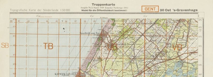
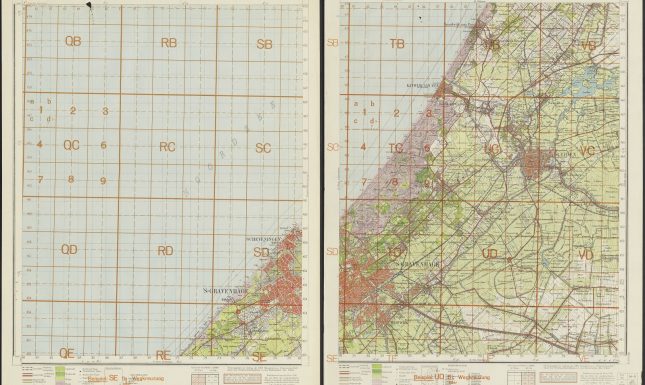
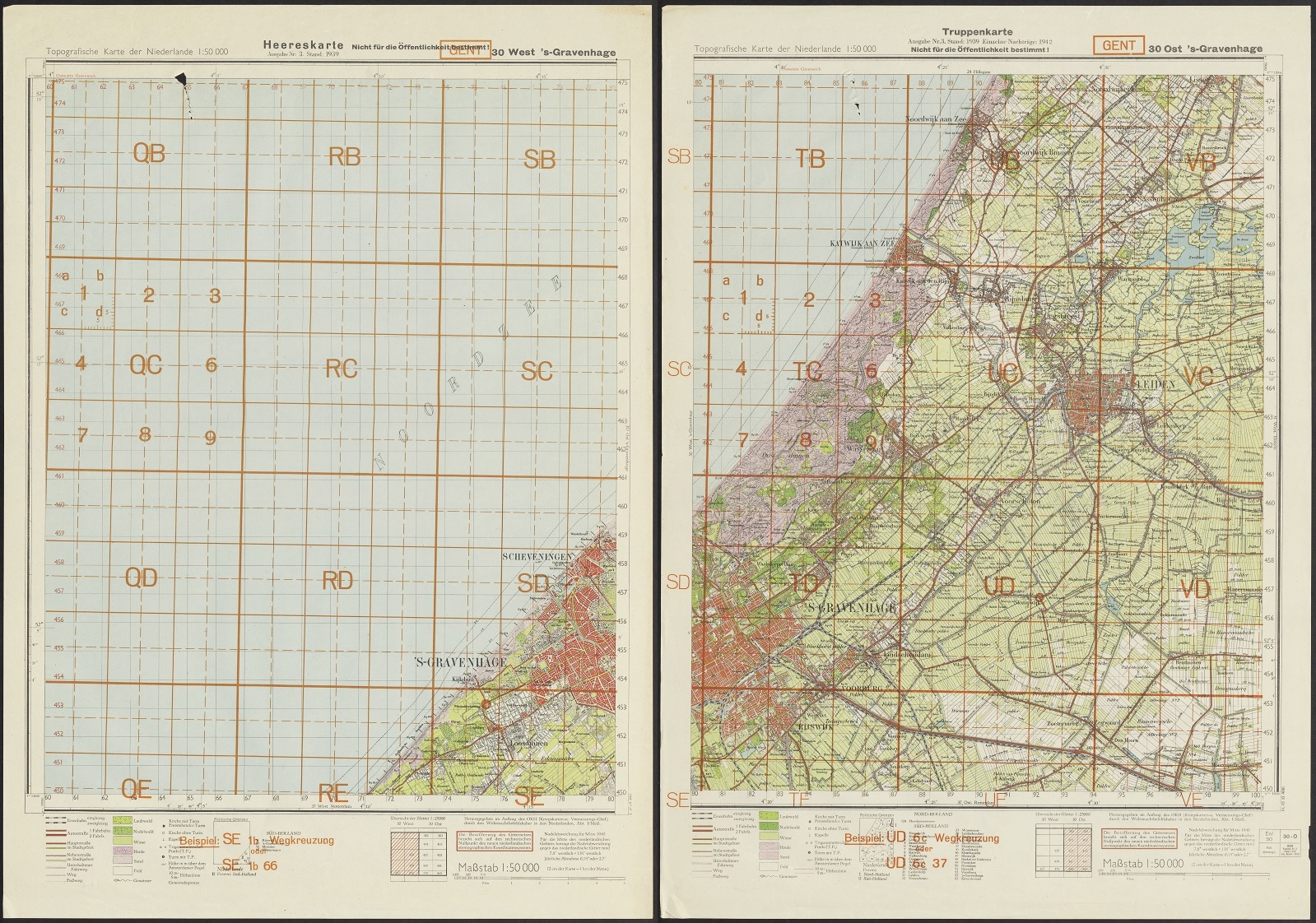
In preparation for the occupation, a topographical map series of the Netherlands 1:50,000 was produced in Germany, as part of a European map series on that scale. The production of this series started as early as 1936. These maps were printed on large sheets and were generally based on the Dutch topographical map series. After the German invasion of the Netherlands, the Topografische Karte der Niederlande 1:50.000 (note that ‘Topografische’ is written in Dutch with an ‘f’ instead of a ‘ph’!) were produced in the Netherlands at the Topographical Service. For this series, the previous large sheets were divided into a West- and East-sheet. The smaller sheets are commonly known as ‘half sheets’. A distinction was made in an edition (Sonderausgabe) for general use and a separate edition for military use (Truppenkarte). On the Truppenkarte sheets, the text ‘Nicht für die Öffentlichkeit bestimmt!” is printed, although a clear distinction between the two series can’t be made. In 1942 the Sonderausgabe was cancelled and the maps were named Heereskarte. To make things even more complicated, sheets produced before the invasion are also titled Heereskarte. In the series at Leiden University Libraries, various sheets are named Sonderausgabe, Truppenkarte and Heereskarte, making it nearly impossible to determine the differences.
The red coordinate grid
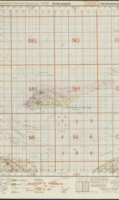
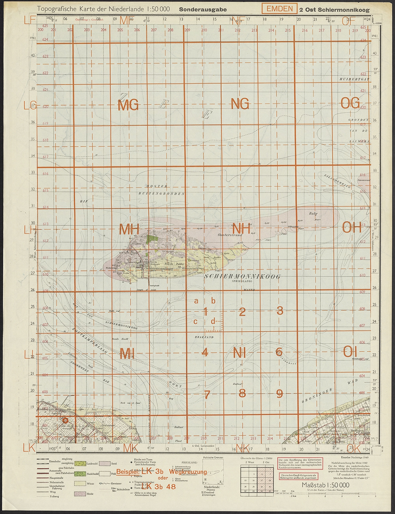
A remarkable feature of the map series kept in Leiden is the red grid overprint, based on a new coordinate grid used by the Germans throughout Europe. This is explained in the margin of the maps: “Die rote Bezifferung des Gitternetzes bezieht sich auf den rechnerischen Nullpunkt des neuen stereographischen Koordinatensystems.” Since each (occupied) country used its own projection and coordinate system, called the Rijksdriehoekcoördinaten (state triangulation coordinates) in the Netherlands, topographic maps of different countries did not exactly fit together. German mapmakers adjusted for this by printing the grid on top of the Dutch maps. Since the systems are slightly different, the German grid is slightly tilted. For the mapping project, the Germans divided Europe into large rectangulars. These rectangulars are named after important cities within their bounds. The entirety of the Netherlands fit in four of these rectangulars: Den Helder (mainly the North Sea), Emden, Gent and Köln. These rectangulars are further subdivided into various levels of squares with letter and number codes. The codes were used to identify a specific location. On every sheet, an example (‘Beispiel’) is printed, such as the crossroad (‘Wegkreuzung’) near Moddergat on the Sonderausgabe sheet ‘2 Ost Schiermonnikoog’. This location is indicated with a red/orange circle on the map and explained in red/orange text (Beispiel) in the lower margin. The occurrence of the grid is quite special since most topographical map sheets of the Netherlands that have survived are lacking this red overprint.
Re-use of old map sheets
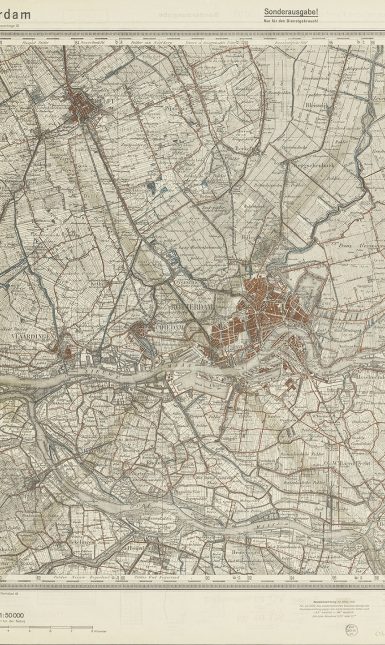
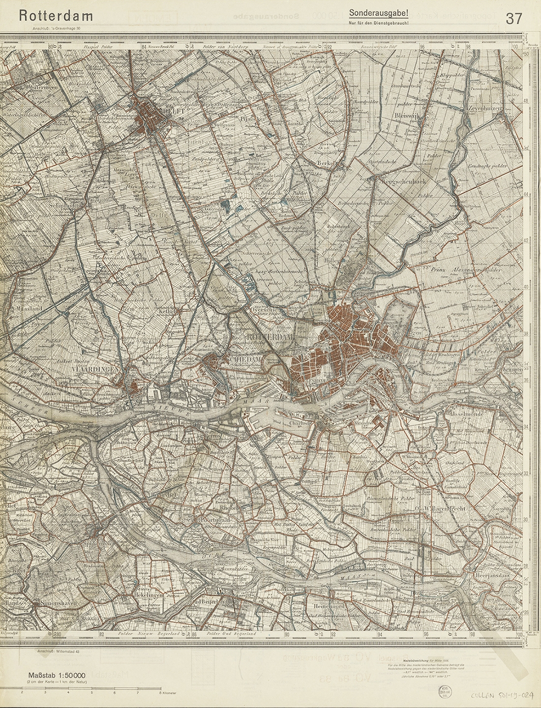
During the war, the availability of paper was limited. Therefore, old topographic map sheets were re-used by printing new issues of maps on the backsides. In the 1:50,000 series in Leiden, seven sheets are printed on the backside of older topographical maps. These earlier maps are identified as older German topographical maps of the Netherlands 1:50,000 from the late 1930s. The original sheet is cut in half, so the backside of these maps could be used to print two new half-sheets. Over the outdated backside, a big grey cross was printed to make clear that the map reader should look on the other side of the sheet. The re-used sheets include maps covering parts of Friesland and Drenthe, a black-and-white sheet of the Rhenen-Tiel region and two copies of the sheet of Rotterdam. The fact that two copies of the same sheet of Rotterdam were re-used for the new series at Leiden could be a coincidence. However, one cannot rule out that extra copies were printed specifically for this sheet, to be used in the preparation of the bombardment of Rotterdam on the 14th of May 1940. If so, after the Rotterdam Blitz, the pre-war topographical map was outdated and could be re-used. The paper scarcity was not only a problem for the Axis powers, but there are also examples of re-used outdated topographical map sheets used by the Allied forces.
Further reading
Adri den Boer, ‘Vijf jaar kaartenmaken in beeld.’ Geo-Info 14 (2017), 5: 38-43.
Jeremy Brotton & Nick Millea, Talking maps. Oxford: Bodleian Library, 2019 (especially chapter 9: War).
Ben de Pater & Ben Schoenmaker, Comprehensive atlas of the Netherlands 1930-1950. Zierikzee: Asia Maior/Atlas Maior, 2005.