

Woerden defended by water
A small atlas with manuscript plans showing the fortification of Woerden.
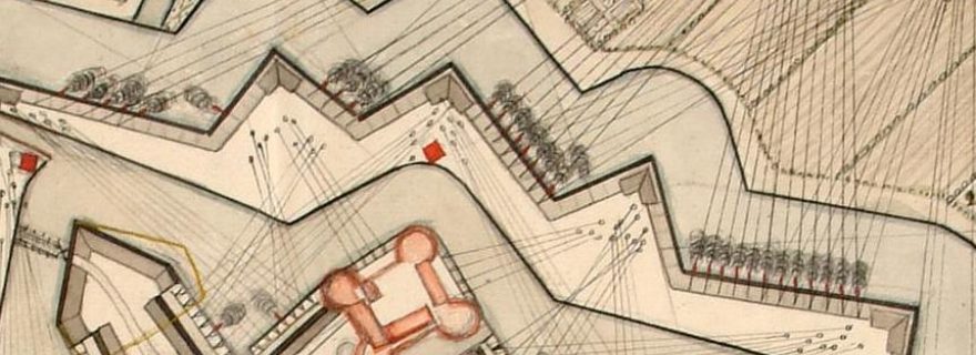
In the Bodel Nijenhuis Collection (COLLBN Port 15 N 101) a remarkable convolute of seven manuscript and printed maps and a printed text is kept. All the maps are concerned with the town of Woerden and plans for fortifications and a waterline. The spine of this factice atlas bears the title ‘Fortificaties tot Woerden’.
Three manuscript plans are concerned with the fortification of the town of Woerden itself. One of these plans is made by the military engineer John Philip Prevost in 1724. A fourth hand-drawn fortification plan is a concept for the construction of a bastion just outside the town. A fifth manuscript plan is about the drainage. The two other maps depict a larger area and are related to the design of a waterline: a manuscript map shows a concept by the famous military engineer Menno van Coehoorn and on a printed map of the province of Utrecht of 1715 by surveyor Bernard de Roij, proposals for different waterlines, including the 'Grebbelinie' and New Dutch Waterline are indicated. These defense lines were only achieved in the eighteenth and nineteenth century. Besides these seven maps, the convolute also contains a printed booklet of 32 pages with a discourse on the project to fortify Woerden, dated 1725.
It can be assumed that this small atlas is composed in, or shortly after, 1725. All seven maps are made before that year.